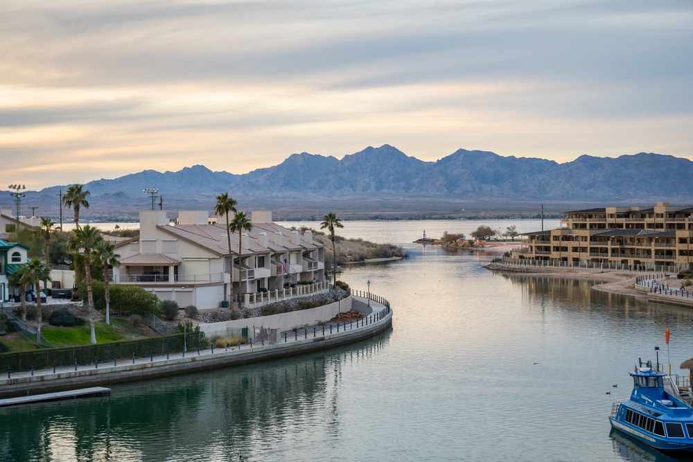
Nestled in the rugged terrain of east-central Arizona, San Carlos Lake emerges as a striking blue oasis surrounded by the dramatic silhouettes of the Gila and Mescal Mountains. This expansive reservoir, one of Arizona’s largest when full, offers a remarkable contrast to the surrounding desert landscape with its deep azure waters reflecting the wide Arizona sky. Located approximately 90 miles east of Phoenix (33.7783° N, 110.5292° W), the lake sits entirely within the 3,000-square-mile San Carlos Apache Indian Reservation, providing a remote yet accessible destination for outdoor enthusiasts.
Visitors can reach this aquatic retreat via US Highway 70, turning south at the town of Peridot onto Coolidge Dam Road (Indian Route 3), which loops around portions of the lake. From major airports, the lake lies about 100 miles east of Phoenix Sky Harbor International Airport and approximately 125 miles north of Tucson International Airport. While the journey requires some planning, the well-maintained highways make the destination accessible for weekend warriors and extended-stay travelers alike.
San Carlos Lake exists thanks to the innovative Coolidge Dam, completed in 1928 and dedicated by President Calvin Coolidge in 1930. Unlike natural lakes, this man-made reservoir was created as part of the San Carlos Irrigation Project to provide reliable water for agriculture in the fertile farmlands downstream from Florence to Casa Grande. The dam’s construction represents an engineering milestone, being the first and possibly only multiple dome and buttress dam design of its kind in the world.
The lake’s name comes from the San Carlos Apache Tribe, whose reservation encompasses the entire body of water. This connection to indigenous history adds cultural significance to the area, though it also means visitors must respect tribal regulations. The reservoir serves dual purposes—providing essential irrigation water for agriculture while creating a recreational haven that supports the local economy through fishing and boating activities.
Throughout its history, San Carlos Lake has experienced dramatic fluctuations in water levels, with the reservoir nearly emptying at least 20 times since the dam’s construction and reaching full capacity only three times. These boom-and-bust cycles have earned it a reputation as a lake that must continuously recreate itself ecologically—a fascinating example of nature’s resilience in the face of human water management needs.

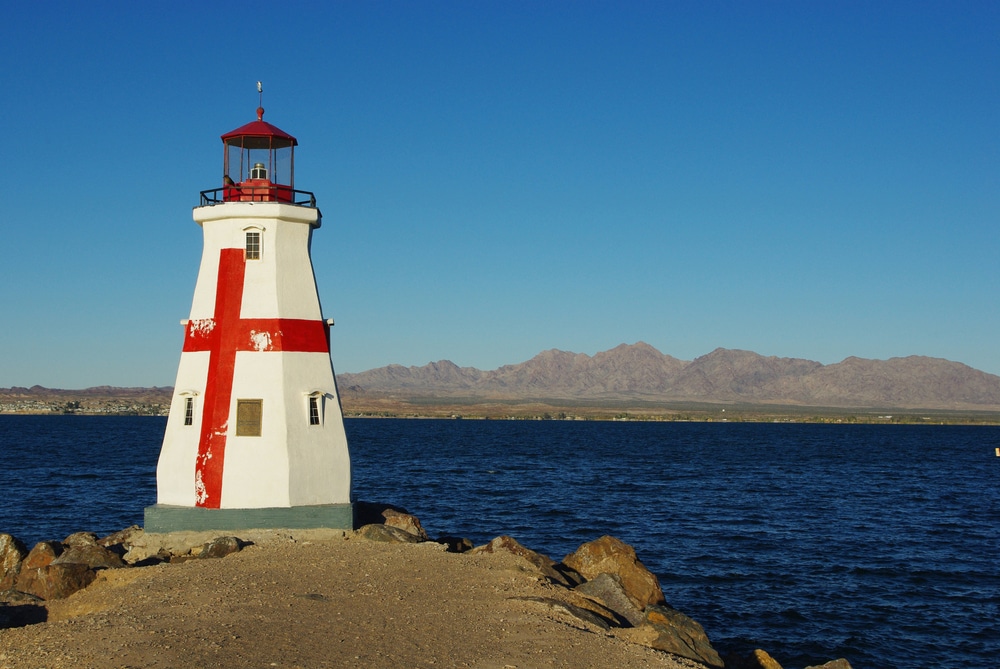
Completed in 1930, Coolidge Dam stands as an impressive engineering achievement with its unique multiple-dome design. Visitors can walk across the top of the dam for spectacular views of both the lake and the downstream canyon. The dam’s distinctive architecture makes it a fascinating photographic subject, particularly when water is flowing through the spillways. Historical markers provide information about the dam’s construction and its importance to water management in Arizona.

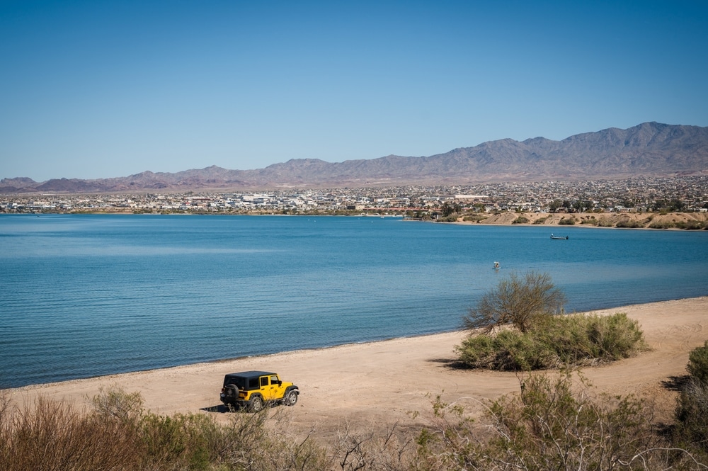
The crystal-clear waters of Lake Havasu offer premier opportunities for swimming, water skiing, wakeboarding, and paddleboarding. The lake’s 450 miles of shoreline provide numerous beaches and coves for water activities. Temperatures remain warm enough for comfortable swimming from spring through fall, with summer water temperatures often reaching the mid-80s Fahrenheit.

The lake’s expansive surface (19,500 acres when full) provides ample space for all types of watercraft. The open waters are perfect for water skiing, wakeboarding, and jet skiing, while the numerous coves offer peaceful paddling opportunities. The San Carlos Recreation Center maintains boat ramps and marina services, including boat rentals, fuel, and supplies. Early mornings typically offer the calmest water conditions before afternoon winds develop.

San Carlos Lake is renowned as one of Arizona’s premier fishing destinations, particularly for bass fishing enthusiasts. The lake hosts abundant populations of largemouth bass, smallmouth bass, crappie, channel catfish, and flathead catfish. When water levels are high, the submerged mesquite trees create ideal fish habitats. The lake has produced record-setting bass catches, with spring and fall typically offering the best fishing conditions. Local guides provide expertise for visitors unfamiliar with the lake’s productive areas.

The terrain surrounding San Carlos Lake features several informal hiking trails that showcase the unique transition zone between Sonoran Desert and higher elevation landscapes. These paths offer panoramic vistas of the lake basin and surrounding mountains. The nearby Mount Turnbull Wilderness provides more challenging hiking opportunities for experienced adventurers seeking to explore remote backcountry areas.

The San Carlos Apache Tribe manages world-class hunting opportunities in the areas surrounding the lake. With proper permits and tribal authorization, hunters can pursue elk, mule deer, javelina, and various game birds according to established seasons. The tribe’s wildlife management practices have created exceptional trophy hunting possibilities, drawing sportsmen from around the country to experience guided and unguided hunts in this diverse terrain.

The lake and surrounding terrain support diverse wildlife including bald eagles, great blue herons, wild turkeys, mule deer, and javelina. The shoreline areas at dawn and dusk offer the best opportunities for wildlife observation. During winter months, the lake hosts significant populations of migratory waterfowl, creating excellent bird watching opportunities. The San Carlos Apache Tribe maintains wildlife viewing areas with informative signage about local species.

San Carlos Lake offers multiple camping options managed by the San Carlos Apache Recreation & Wildlife Department. The Point of Pines area provides developed campsites with amenities, while primitive camping is permitted along much of the shoreline. The Gila Mountain and Ash Creek areas offer particularly scenic camping locations with direct lake access. Campers should check with tribal authorities regarding current permits and regulations.

The dramatic landscapes surrounding San Carlos Lake create exceptional photography opportunities. The contrast between blue waters and surrounding mountain ranges is particularly striking at sunrise and sunset. The view from Coolidge Dam offers panoramic photo possibilities, while the many coves and inlets provide intimate scenes of desert meeting water. Seasonal wildflower blooms transform the landscape with vibrant colors following spring rains.
San Carlos Lake has earned a legendary reputation among Arizona anglers, often described as “the lake to go to when fish won’t bite anywhere else.” The reservoir’s productive waters have yielded multiple state records, including notable achievements for largemouth bass, black crappie, and flathead catfish. This fishing productivity stems partly from the submerged mesquite and palo verde trees that create ideal fish habitat along the shoreline coves and points.
The lake supports an impressive variety of game fish species. Anglers can target largemouth bass, which thrive in the warm waters and can reach trophy sizes exceeding 10 pounds. Other popular species include black crappie, known for their delicious fillets and schooling behavior; channel catfish and flathead catfish, which can reach massive sizes in these fertile waters; and various sunfish species including bluegill. During cooler months, the lake is stocked with rainbow trout and brown trout from cold-water fisheries, providing additional angling opportunities.
Prime fishing locations vary seasonally, but consistently productive areas include the backs of coves where flooded timber creates structure, main lake points where depth changes create feeding zones, and areas near the dam where deeper water concentrates fish during hot weather. The lower end of the lake generally offers more consistent fishing due to its greater average depth, while the upper reaches can be phenomenal during high water periods when newly flooded vegetation attracts baitfish and predators.
Seasonal patterns heavily influence fishing success at San Carlos. Spring typically offers the best overall fishing as water temperatures warm and fish become active for spawning. Summer fishing can be productive during early morning and evening hours, with deeper water tactics prevailing during midday heat. Fall brings another period of increased activity as fish feed heavily before winter. Winter fishing focuses on slower presentations and deeper water, with trout fishing becoming prominent after stockings.
Specific regulations apply to fishing on San Carlos Lake, reflecting its location on tribal lands. All non-tribal anglers must purchase a San Carlos Apache Tribe fishing permit, available for daily use ($10) or as an annual permit ($130). Creel limits are generally liberal compared to state-managed waters, with daily limits of 10 bass, 25 catfish, and 25 crappie. A boat permit ($5) is also required for any watercraft use. These permits can be purchased at the San Carlos Recreation and Wildlife Department office or at authorized vendors, including the Bashas’ supermarket near the reservation entrance and the Soda Canyon General Store near the lake.
Fishing guides are available through the San Carlos Recreation and Wildlife Department, with many tribal members offering expert guidance based on generations of local knowledge. Several fishing tournaments occur throughout the year, though schedules can vary based on water levels and tribal policies.
San Carlos Lake provides extensive boating opportunities across its expansive surface, with minimal restrictions on watercraft types. Both motorized and non-motorized vessels are permitted, with no specific horsepower limitations on the main reservoir. This open policy allows for everything from high-speed power boats and personal watercraft to kayaks, canoes, and paddleboards.
The primary boat launch facility is located at Soda Canyon, approximately nine and a half miles south from the US 70-Arizona 170 junction and just one mile from the dam. This facility features a 60-foot wide concrete ramp that accommodates multiple vessels simultaneously when water levels permit. The ramp’s design accounts for water level fluctuations, though extremely low water conditions can limit access.
Navigation considerations include submerged timber and fluctuating water levels that can create hazards. Boaters should exercise caution, particularly in unfamiliar areas or during periods of changing water levels. No-wake zones exist near the dam and in designated swimming areas. The central portion of the lake generally provides open water for higher-speed activities, while the numerous coves and inlets offer protected areas for fishing and more relaxed boating.
A marina at Soda Canyon provides basic services, though amenities can vary based on seasonal operations and water levels. Fuel availability is limited, so boaters should plan accordingly and bring sufficient fuel for their outings. Boat rentals are occasionally available through private vendors, but availability is not guaranteed, making it advisable to bring your own watercraft if possible.
All boats require a tribal boating permit ($5 daily or $100 annually), available at the same locations as fishing permits. Safety equipment requirements follow standard U.S. Coast Guard regulations, with life jackets required for all passengers. San Carlos Apache tribal rangers patrol the lake periodically to enforce boating regulations and ensure safety.
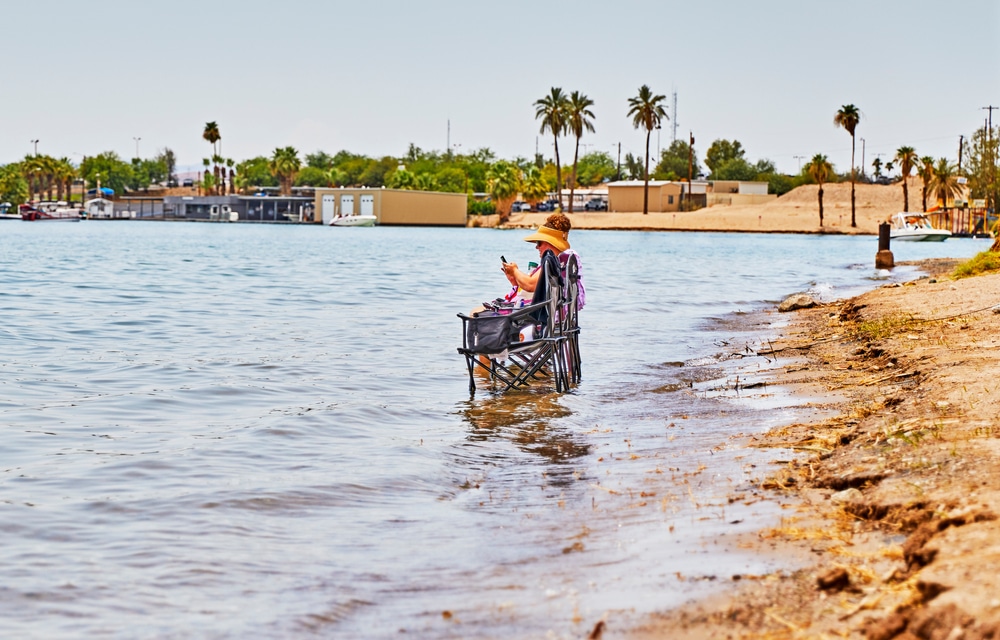
San Carlos Lake offers several designated swimming areas when water levels permit, primarily concentrated around the Soda Canyon recreation area. These swimming beaches feature gradually sloping entry points that are family-friendly, though no lifeguards are present, making swimming a swim-at-your-own-risk activity. Restroom facilities are available at main recreation areas, with picnic tables and shade structures providing comfortable spaces for day use.
Water quality for swimming varies seasonally, with clearest conditions typically occurring during winter and spring. Summer monsoon rains can temporarily reduce visibility due to runoff, though the water remains suitable for recreation. The lake has no consistent history of harmful algae blooms, but visitors should check with the San Carlos Recreation and Wildlife Department for current conditions.
Beyond swimming, the lake accommodates a wide range of water sports. Water skiing and wakeboarding enjoy popularity in the main lake areas, where open water provides ample room for safe operation. Jet skiing and tubing are similarly popular, with no specific areas designated exclusively for these activities. For those preferring non-motorized recreation, kayaking and paddleboarding opportunities abound, particularly in the protected coves and inlets where wildlife viewing combines with peaceful paddling experiences.
Specific areas for water sports are not formally designated, but natural patterns of use have emerged. The wider sections of the main lake, away from the dam and heavy fishing pressure, tend to attract water skiers and similar high-speed activities. The numerous coves provide more protected waters for paddlers and swimmers, creating natural segregation of potentially conflicting uses.
Restrictions on water sports are minimal but include standard safety considerations such as maintaining safe distances from other boats, swimmers, and the dam structure itself. All water sport participants should be aware that water levels can fluctuate significantly, potentially exposing hazards like submerged trees, rocks, or old structures that may not be visible from the surface.
| Category | Details |
|---|---|
| Location | Southeastern Arizona, USA (on the San Carlos Apache Reservation) |
| Formation | Created by Coolidge Dam, completed in 1930 |
| Surface Area | Approximately 19,500 acres (79 km²) when full |
| Maximum Capacity | 910,000 acre-feet (1.12 km³) |
| Normal Capacity | Around 358,000 acre-feet (442 million m³) |
| Dam Type | Multiple dome concrete arch (three domes) |
| Dam Height | 249 feet (76 m) |
| Dam Length | 916 feet (279 m) |
| Water Source | Gila River |
| Purpose | Irrigation water storage, flood control, recreation |
| Named After | Dam: President Calvin Coolidge; Lake: San Carlos Apache Reservation |
| Management | San Carlos Apache Tribe and Bureau of Indian Affairs |
| Recreation | Fishing, boating, camping, hunting (permit required) |
| Notable Fish Species | Largemouth bass, smallmouth bass, crappie, catfish, carp |
| Challenges | Frequently experiences low water levels due to drought and irrigation demands |
| Historical Significance | First major irrigation project built with Indian Appropriation Act funds |
| Unique Feature | One of few multiple-dome dams in the United States |
| Wildlife | Bald eagles, waterfowl, desert bighorn sheep |
| Distinction | At one time was the largest artificial lake in the world |
| Cultural Importance | Located on and significant to the San Carlos Apache Tribe |
San Carlos Lake stretches across the landscape with impressive dimensions when at full capacity. The reservoir boasts a substantial surface area that fluctuates seasonally, but at its maximum, it encompasses approximately 19,500 acre-feet of water, making it one of Arizona’s largest lakes when full. The shoreline extends for a remarkable 158 miles, creating numerous coves, inlets, and points that provide varied fishing and recreational opportunities.
The lake’s depth profile varies considerably, with a maximum depth of approximately 75 feet near the dam. Most of the reservoir, however, maintains a relatively shallow profile with few dramatic drop-offs, creating a big, spreading basin. This topography is ideal for warm-water fish species and contributes to the lake’s reputation as a premier fishing destination.
Situated at an elevation of 2,425 feet above sea level, San Carlos Lake enjoys a climate that balances desert heat with moderate conditions, making it accessible year-round. The reservoir forms an irregular shape that follows the original river valleys and adjacent low-lying areas that were flooded when the dam was constructed.
The water feeding San Carlos Lake comes primarily from the Gila River, with additional input from the San Carlos River. These waterways collect runoff from a vast watershed across eastern Arizona, delivering seasonal surges during monsoon seasons and spring snowmelt. Water quality varies seasonally, typically offering reasonable clarity in cooler months and becoming more turbid during periods of heavy runoff.
Throughout the year, water temperatures range from winter lows in the 50s (°F) to summer highs that can exceed 80°F in shallow areas. This wide temperature range supports diverse aquatic life but also creates seasonal patterns in fish behavior that savvy anglers learn to anticipate.
The landscape surrounding San Carlos Lake presents a fascinating ecological transition zone. The immediate shoreline features desert terrain dominated by mesquite, palo verde, and various cactus species. This Sonoran Desert ecosystem gradually gives way to higher elevation vegetation on the surrounding mountains. The area is ringed by three national forests—Coronado to the south, Tonto to the west, and Apache to the east—creating a diverse ecological setting that transitions from mid-altitude desert to high-country forests.
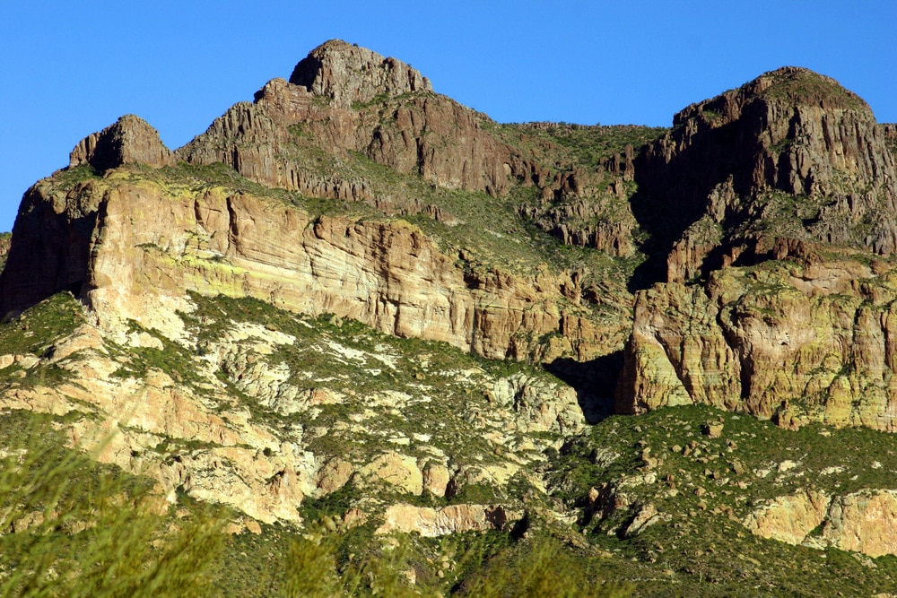
An interesting geological note is that the lake bottom contains thousands of submerged mesquite and palo verde trees that were present before the dam’s construction. These underwater structures create valuable fish habitat and contribute to the lake’s productive fishing environment. The surrounding mountains—primarily the Gila and Mescal ranges—consist of volcanic and sedimentary formations typical of the Basin and Range province of the American Southwest, adding scenic drama to the reservoir’s setting.
The Coolidge Dam stands as an engineering marvel and historical landmark in Arizona’s water management history. Constructed between 1924 and 1928 by the Bureau of Indian Affairs (BIA) at a cost of $10 million (equivalent to approximately $152 million today), the dam was officially dedicated by President Calvin Coolidge on March 4, 1930. The project was named after the 30th U.S. president, adding to its historical significance.
The dam features a unique multiple dome and buttress design that distinguishes it from other water control structures. Rising to a height of 249 feet with a crest length of 580 feet, Coolidge Dam incorporates three large concrete domes supported by massive buttresses spaced at 100-foot intervals. This architectural approach was pioneering, as it represents the first—and possibly only—multiple dome dam design of its kind in the world. The construction required approximately 200,000 cubic yards of concrete to complete the domes, buttresses, and spillways.
The distinguished engineer Herman Neuffer led the design and construction effort, overseeing much of the Bureau of Indian Affairs’ construction work in Arizona and New Mexico during the 1920s. His innovative approach to the multiple dome design created a structure that was both functionally effective and visually distinctive, with the three domes resembling a series of eggs standing on end when viewed from downstream.
Coolidge Dam was built as a key component of the San Carlos Irrigation Project, with the primary purpose of providing irrigation water to approximately 100,000 acres of farmland in the fertile areas around Florence, Coolidge, and Casa Grande. The dam’s water management role extends to flood control, though this aspect took on greater importance after significant flooding events, particularly the major flood of January 1993 when the dam withstood water flows seven times higher than its expected maximum release rate.
The Bureau of Indian Affairs continues to own and operate the dam today, managing water releases according to irrigation needs and other considerations. The structure features two uncontrolled ogee crest spillways that are concrete-lined and located on each abutment, providing overflow capacity during high water events.
Originally, the dam incorporated hydroelectric generation capabilities, with a power plant completed in 1935. A complementary diesel electric generating plant was built near the town of Coolidge to provide electricity for irrigation wells, local communities, and mining operations. Unfortunately, flood damage in 1983 rendered the hydroelectric station inoperable, and restoration was deemed economically unfeasible. Currently, electricity for the San Carlos Irrigation Project is delivered by the Western Area Power Administration.
The construction of the dam was not without controversy. The Apache tribe initially opposed the project, fearing violation of their treaty rights—particularly regarding ancestral burial grounds located in the area to be flooded. A compromise was eventually reached wherein a concrete slab was placed over the principal burial ground, allowing it to remain in place as the waters rose behind the dam. This historical detail highlights the cultural complexities involved in the dam’s development.
In 1988, the Bureau of Reclamation completed a study concluding that Coolidge Dam required modifications to prevent potential failure during significant floods or earthquakes. Subsequent retrofit work has been undertaken to ensure the dam’s continued safe operation. Public access to the dam is permitted, with pullouts atop the structure allowing visitors to view both the dam itself and the canyon below. However, no formal tours of the dam’s interior or operational facilities are currently offered.
San Carlos Lake offers varied camping experiences ranging from developed sites to primitive backcountry opportunities. The primary developed campground is Soda Canyon Point Campground, situated on the northwest shore near the marina and boat ramp facilities. This campground provides basic amenities including picnic tables, fire rings, potable water, and vault toilets. Sites accommodate both tents and RVs, though hookups are not available. The campground’s elevation and lakeside location offer spectacular views and cooling breezes during warmer months.
Most camping sites operate on a first-come, first-served basis with no reservation system in place. Developed campsite fees are included with the recreation permit required for all visitors to tribal lands. Availability rarely reaches capacity except during major fishing tournaments or holiday weekends, making this a reliable option for spontaneous trips.
For those seeking a more primitive experience, dispersed camping is permitted along much of the shoreline, allowing visitors to find secluded spots away from developed areas. These sites lack amenities but offer greater privacy and direct lakeside access. High-clearance vehicles are recommended for reaching many of these areas, particularly after rainfall when unpaved roads can become challenging.
Basic camping regulations include a 14-day maximum stay within any 30-day period. Campers must pack out all trash, and collection of firewood is prohibited without specific permission. Campfires are permitted within established fire rings but may be restricted during periods of high fire danger. Quiet hours typically run from 10 PM to 6 AM, though enforcement is limited in more remote areas.
Pet policies allow dogs in camping areas but require them to be leashed at all times. Owners must clean up after their pets and ensure they don’t disturb wildlife or other campers. Unfortunately, many camping areas lack shade, so summer visitors should bring their own shade structures for comfort during daylight hours.
For those preferring more comfortable accommodations, options near the lake are limited. The nearest hotels are found in Globe/Miami (approximately 30 miles west) and include national chain properties like Hampton Inn and Quality Inn, along with independent motels. These provide standard amenities including air conditioning, wifi, and breakfast service, with rates typically ranging from $85-150 per night depending on season and amenities.
The Apache Gold Casino Resort near Globe offers a full-service hotel experience including a restaurant, entertainment, and recreational facilities, with room rates starting around $120 per night. For extended stays, vacation rentals are occasionally available in surrounding communities, though selection is limited compared to more developed tourist areas.
The reservation itself has minimal lodging options, with no developed cabins or lodges at the lake. Visitors planning overnight trips should either prepare for camping or arrange accommodations in nearby communities. The relative isolation of San Carlos Lake means that advance planning is essential, particularly for visits during peak fishing seasons or summer weekends when accommodations in the broader region may fill quickly.
The ecosystem surrounding San Carlos Lake represents a fascinating transition zone between Sonoran Desert and higher elevation habitats. This ecological diversity supports an impressive array of plant and animal species that visitors can observe throughout the year.
The plant community reflects the area’s semi-arid character, with the lower elevations dominated by mesquite, palo verde, creosote bush, ocotillo, and various cacti including prickly pear, cholla, and the iconic saguaro. Moving upslope into the surrounding foothills, visitors encounter juniper, oak woodlands, and eventually pine forests at the highest elevations. Springtime (March-April) brings spectacular wildflower displays when conditions are favorable, with Mexican gold poppies, lupines, and globe mallows creating carpets of color, particularly on Peridot Mesa.
Birdwatching opportunities abound with more than 200 recorded species in the area. Year-round resident birds include great blue herons, ospreys, red-tailed hawks, greater roadrunners, Gambel’s quail, and numerous songbirds. The lake serves as an important stopover for migratory waterfowl, with winter months bringing substantial populations of ducks, geese, and occasional bald eagles. Rare sightings include Mexican spotted owls in the higher elevation forests surrounding the lake.
Mammals are well-represented around San Carlos Lake, with mule deer, white-tailed deer, javelina, and various rodent species commonly observed. More elusive residents include bobcats, coyotes, gray foxes, and occasionally black bears in the surrounding mountains. The reservation is also home to a healthy population of Rocky Mountain elk and desert bighorn sheep, though these typically remain in less accessible areas away from heavy human activity.
The reptile and amphibian community is diverse, featuring western diamondback rattlesnakes, Gila monsters, desert tortoises, and several lizard species including the colorful collared lizard. Visitors should exercise appropriate caution regarding venomous species but need not be unduly concerned with proper awareness and respect for wildlife.
For optimal wildlife viewing, early morning and late afternoon hours provide the greatest activity, particularly at water’s edge where animals come to drink. The upper reaches of the reservoir, where the Gila and San Carlos Rivers enter, offer excellent opportunities to observe waterbirds and riparian species. Binoculars and a field guide enhance the experience considerably.
The San Carlos Apache Tribe has implemented several conservation initiatives to protect the lake’s ecosystem, including habitat improvement projects, invasive species management, and water quality monitoring. The tribe’s natural resources department works to balance recreational use with ecological preservation, employing both modern scientific approaches and traditional ecological knowledge.
Nature trails are limited but include informal paths around the Soda Canyon recreation area and more developed hiking opportunities at nearby Peridot Mesa. The tribe occasionally offers interpretive programs focusing on traditional Apache uses of native plants and wildlife, providing cultural context to the natural environment. For the best wildlife viewing experience, visitors should maintain quiet observation, stay on established trails when possible, and avoid disturbing animals at water sources.
San Carlos Lake experiences distinct seasonal changes that significantly impact recreational opportunities throughout the year. Understanding these patterns helps visitors maximize their experience regardless of when they visit.
Spring (March-May) typically offers the most favorable overall conditions. Temperatures range pleasantly from daytime highs of 70-85°F to nighttime lows in the 50s, perfect for camping and extended outdoor activities. This season generally sees stable water levels as winter precipitation has accumulated in the reservoir, and demand for irrigation water has not yet peaked. Fishing reaches its prime as bass and crappie move into shallow waters for spawning, making them more accessible to anglers. Spring also brings spectacular wildflower displays, particularly on Peridot Mesa, and increased wildlife activity as animals emerge from winter patterns.
Summer (June-September) brings considerable heat, with daytime temperatures regularly exceeding 95°F and occasionally surpassing 105°F. Early mornings and evenings remain pleasurable, but midday activities can be challenging without proper preparation. Summer also brings the Arizona monsoon season (typically July-September), when afternoon thunderstorms can develop rapidly, creating temporarily dangerous conditions on the water. Water levels often decline throughout summer due to irrigation demands downstream, potentially limiting boat access at some launch points. Fishing remains productive during early morning and late evening hours, with catfish becoming particularly active. Higher elevation areas surrounding the lake provide relief from valley heat.
Fall (October-November) returns to moderate temperatures similar to spring, with daytime highs in the 70-85°F range and increasingly cool nights. Water levels typically reach their annual low point, revealing lake features normally submerged. This concentration of water can actually improve fishing success as fish become concentrated in smaller areas. Fall brings fewer visitors than spring or summer, making it ideal for those seeking solitude. Wildlife activity increases as animals prepare for winter, and the surrounding landscape takes on subtle autumn hues.
Winter (December-February) is characterized by cool to cold conditions, with daytime temperatures averaging 50-65°F and nighttime temperatures occasionally dropping below freezing. The reservoir begins to refill from winter precipitation, though significant changes in water level depend on seasonal rainfall and snowmelt patterns. Trout fishing becomes prominent following winter stockings, while bass and crappie move to deeper water and require slower fishing techniques. The winter months bring the fewest visitors, offering maximum solitude, and waterfowl populations peak as migratory birds utilize the lake as a stopover or wintering ground.
Water level fluctuations represent the most significant variable affecting recreation. The reservoir typically reaches its highest levels in late spring following winter precipitation and spring runoff. Levels gradually decline throughout summer and early fall as water is released for downstream irrigation. By late fall, the lake often reaches its annual low point before beginning to refill with winter rains. These fluctuations can dramatically affect boat launch access, fishing success, and the overall appearance of the lake.
Seasonal events include spring fishing tournaments targeting bass and crappie, summer recreational boating peaks during holiday weekends, fall hunting seasons in surrounding areas, and winter bird migrations that attract birdwatchers. Visitors planning activities around specific water levels should contact the San Carlos Recreation and Wildlife Department for current conditions, as levels can vary significantly from year to year based on precipitation patterns and irrigation demands.
Visitors to San Carlos Lake must understand certain essential requirements before arriving, as the lake sits entirely within the San Carlos Apache Indian Reservation and operates under tribal jurisdiction.
All non-tribal visitors require permits to access the lake and participate in recreational activities. The basic recreation permit costs $10 per day and covers a married couple with children under 17 years old (children 17 and older require individual permits). This permit allows for hiking, camping, and general access. Fishing permits cost $10 per day or $130 annually. Boat permits are $5 daily. The Black River special use permit, required for accessing that area, costs $20 daily per person over 12 years of age. All permits can be purchased at the San Carlos Recreation and Wildlife Department office in San Carlos, at the Bashas’ supermarket near the reservation entrance, or at the Soda Canyon General Store near the lake.
The lake area typically operates 24/7 with no specific closing times for general access, though the Recreation and Wildlife Department office maintains regular business hours (Monday-Friday 8 AM-4:30 PM, Saturday 8 AM-noon). Seasonal closures occasionally occur due to religious ceremonies, conservation needs, or extreme fire danger, so checking current status before traveling is advisable.
The San Carlos Recreation and Wildlife Department serves as the primary ranger station, located in the town of San Carlos. Rangers patrol the area regularly, enforcing regulations and assisting visitors. For emergencies, visitors should call 911, though cell phone reception can be limited around the lake. The nearest medical facilities are in Globe, approximately 30 miles west of the lake, with urgent care facilities and a regional hospital (Cobre Valley Regional Medical Center).
Cell phone coverage varies considerably throughout the area. Major carriers provide reasonable service near the towns of San Carlos and Peridot and around the Coolidge Dam, but coverage becomes spotty to non-existent in many coves and more remote shoreline areas. Visitors should not rely exclusively on cell phones for emergency communication or navigation.
Accessibility accommodations for visitors with disabilities are limited. The Soda Canyon recreation area offers some accessible facilities, including restrooms and picnic areas with paved pathways. However, most shoreline access points involve uneven terrain. The main boat ramp can accommodate visitors with mobility challenges during appropriate water levels.
Potable drinking water is available at the Soda Canyon developed recreation area but is limited or unavailable at most other locations around the lake. Visitors should bring ample water supplies, particularly during warmer months when dehydration risks increase significantly.
Waste disposal facilities include dumpsters at the main recreation areas, but remote locations lack such amenities. Visitors must pack out all trash and dispose of it properly. No recycling facilities exist on-site, so recyclable materials should be transported to facilities in nearby communities.
Fire regulations vary seasonally, with complete bans possible during periods of high fire danger. When permitted, fires must be contained within established fire rings in developed areas, while dispersed camping locations require portable fire pans. Current fire restrictions are posted at the Recreation and Wildlife Department office and at entrance points to the reservation.
Pets are allowed throughout most of the recreation area but must remain leashed at all times. Owners must clean up after their animals and ensure they don’t disturb wildlife or other visitors. Pets should never be left unattended, particularly during hot weather when vehicles can reach dangerous temperatures rapidly.
While San Carlos Lake offers abundant recreation in itself, several nearby attractions provide additional opportunities for visitors looking to expand their Arizona experience.
The town of Globe, located approximately 30 miles west of the lake, serves as the primary gateway community and offers various amenities and attractions. This historic mining town features a well-preserved downtown with antique shops, local restaurants, and the Gila County Historical Museum housed in the former county jail. Local dining options include Chalo’s Casa Reynoso for authentic Mexican cuisine, the Copper Hen for American comfort food, and Vida e Caffe for coffee and light fare. Globe provides all essential services including grocery stores, medical facilities, hardware stores, and automotive services.
The community of San Carlos, about 15 miles north of the lake, offers more limited services but includes the Apache Gold Casino Resort, which features gaming, dining options, and occasional live entertainment. The on-site Apache Grill restaurant serves three meals daily, incorporating some traditional Apache dishes along with standard American fare.
Within a one-hour drive, visitors can access several significant attractions. Tonto National Monument, approximately 40 miles west, preserves well-maintained cliff dwellings constructed by the Salado culture in the 13th-15th centuries. Guided tours provide fascinating insights into ancient life in the region. The Salt River Canyon, about 45 miles north, offers spectacular scenery often compared to a smaller version of the Grand Canyon, with dramatic overlooks and hiking opportunities.
For outdoor enthusiasts, the nearby Pinal Mountains provide higher-elevation hiking trails that offer cooler temperatures during summer months. The Six Shooter Canyon and Ice House Canyon trails are popular routes that showcase diverse plant communities and occasional wildlife sightings.
The area holds significant indigenous history as the traditional homeland of the Apache people. Tribal cultural sites on the reservation include Peridot Mesa and ancient petroglyphs, though some locations require special permission to visit or guided access through authorized tribal representatives. The San Carlos Cultural Center in the town of San Carlos offers exhibits on Apache history, traditional crafts, and contemporary tribal life.
Natural features worth exploring include hot springs near Eden (45 miles southeast), though seasonal access restrictions may apply, and the dramatic rock formations of the Dripping Springs Mountains visible from various points around the lake. Peridot, a semi-precious gemstone, occurs naturally in the area, with limited collecting opportunities available with proper permission.
For those interested in mining history, the communities of Miami and Superior (within 50 miles) offer views of active mining operations and historic sites that tell the story of Arizona’s copper industry. The Boyce Thompson Arboretum near Superior showcases desert plants from around the world in a beautifully landscaped setting alongside natural desert habitat.
Preparation makes all the difference when visiting San Carlos Lake, and these insider tips will help ensure a successful trip to this unique Arizona destination.
Essential packing items vary by season but should always include more water than you think necessary (at least one gallon per person per day in summer), high-SPF sunscreen, broad-brimmed hats, and polarized sunglasses. During warmer months (April-October), lightweight, light-colored clothing with UPF protection proves invaluable, while winter visitors should pack layered clothing to accommodate significant temperature variations between day and night. Technical fabrics that wick moisture perform better than cotton in this environment.
Sun protection becomes critical in the high desert setting, where both direct and water-reflected sunlight can cause severe burns quickly. Apply sunscreen (minimum SPF 30) before arriving at the lake and reapply every two hours or after swimming. Seek natural shade when possible or bring portable shade structures for beach areas that lack tree cover. Even on cloudy days, UV exposure remains significant at this elevation.
Preventing common desert recreation issues starts with proper hydration—dehydration precedes most heat-related emergencies. Signs of dehydration include dark urine, headache, dizziness, or extreme thirst. Heat exhaustion presents as heavy sweating, weakness, cold/clammy skin, and nausea; seek shade and cooling immediately if these symptoms appear. For water activities, the lake’s fluctuating levels create changing underwater hazards, so swimmers should enter water feet-first and boaters should maintain awareness of submerged obstacles, particularly in unfamiliar areas or after water level changes.
Photographers find prime conditions during the “golden hours” around sunrise and sunset when light quality peaks and wildlife activity increases. The eastern side of the lake offers spectacular sunrise images with mountains silhouetted against the morning sky, while the western shore provides better sunset compositions with light reflecting across the water’s surface. The Coolidge Dam itself, with its unique multiple dome design, offers compelling architectural photography opportunities, particularly when shot from downstream with morning light illuminating the face.
Hidden gems include the small, unnamed coves along the southern shoreline that provide secluded fishing spots accessible by boat or high-clearance vehicles. The area where the San Carlos River enters the lake offers excellent birdwatching opportunities, particularly during migration seasons. For land-based exploration, the overlook near Coolidge Dam provides panoramic views of both the reservoir and the downstream river canyon.
Avoiding crowds proves easiest by visiting midweek rather than weekends, particularly during spring and fall when weather conditions are most favorable. Early morning starts not only provide better fishing and wildlife viewing but also secure the best camping spots during busy periods. If visiting during summer holidays or major fishing tournaments, arrive a day early to ensure access to preferred areas.
Etiquette expectations include respecting tribal land and cultural sites, staying on established roads and trails, and understanding that photographing tribal members or ceremonies requires explicit permission. Leave-no-trace principles apply throughout the area, with particular emphasis on proper waste disposal and minimizing impact at primitive camping locations. Fire safety takes precedence year-round but becomes critically important during the dry pre-monsoon months (April-June).
Local hazards to remain aware of include flash floods during monsoon season, when distant thunderstorms can send water rushing through normally dry washes with little warning. Venomous creatures like rattlesnakes and scorpions rarely pose problems when given appropriate space, but checking shoes and bedding before use prevents uncomfortable surprises. Steep shorelines can develop as water levels drop, creating hazardous conditions for launching or retrieving boats at unauthorized points. Finally, the lake’s remote location means that self-sufficiency becomes essential—bring adequate supplies, inform someone of your plans, and prepare for limited emergency services.
San Carlos Lake stands as a remarkable testament to nature’s resilience and the enduring relationship between humans and water in the arid Southwest. This expansive blue jewel, set against the rugged backdrop of Arizona’s mountains and desert, offers visitors an authentic outdoor experience that balances recreational opportunities with natural beauty and cultural significance.
What truly distinguishes San Carlos Lake from other Arizona watersheds is its dynamic character. Few lakes experience such dramatic fluctuations, transforming from a vast inland sea to a modest stream and back again through the seasons and years. This ongoing cycle of renewal has created a unique ecosystem that continuously adapts and thrives despite challenging conditions—much like the people who have called this region home for countless generations.
The lake represents an important ecological and cultural resource that merits conscientious stewardship. Visitors play a vital role in preserving this special place by practicing responsible recreation—observing tribal regulations, minimizing environmental impact, and developing an appreciation for the delicate balance that sustains both the reservoir and the downstream communities dependent on its waters.
As you leave the shores of San Carlos Lake, take with you not just memories of sun-dappled waters and the weight of a fish on the line, but also a deeper understanding of water’s preciousness in the desert Southwest. In this landscape where water means life itself, San Carlos Lake serves as both natural haven and vital resource—a dual role that makes it all the more worthy of protection for future generations to experience and enjoy.
Whether you come for world-class fishing, scenic boating, peaceful camping, or simply to witness the engineering marvel of Coolidge Dam, San Carlos Lake rewards visitors with an authentic Arizona experience far from the tourist crowds. Here, in this place where desert meets water, visitors find not just recreation but a connection to something deeper—the timeless rhythms of a landscape shaped by both natural forces and human ingenuity. The lake beckons you to return, to witness its ever-changing moods, and to become part of its continuing story.