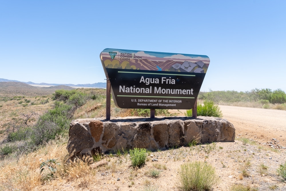
Nestled in the rugged terrain of central Arizona, approximately 40 miles north of Phoenix, lies one of the state’s most archaeologically significant yet often overlooked public lands: Agua Fria National Monument. Designated in January 2000 by Presidential Proclamation, this 70,900-acre monument protects an extraordinarily well-preserved prehistoric landscape featuring hundreds of archaeological sites, ancient pueblos, and one of the most significant concentrations of rock art in the American Southwest.
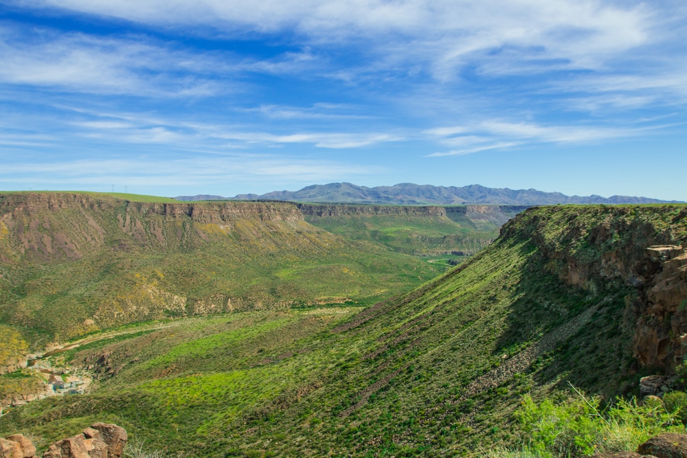
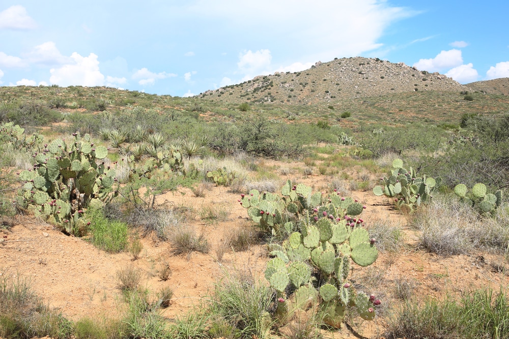
The monument takes its name from the Agua Fria River, a perennial waterway that cuts through black basalt mesas and creates a dramatic riparian corridor in an otherwise arid landscape. This diverse terrain encompasses semi-desert grasslands, chaparral, and riparian forests, supporting an impressive variety of plant and animal species adapted to the transitional zone between the Sonoran Desert and the mountains of central Arizona.
Agua Fria offers visitors a rare opportunity to explore a landscape that remains much as it appeared to its earliest human inhabitants over a thousand years ago. Unlike more developed national monuments, Agua Fria presents a more primitive recreational experience, rewarding those willing to venture off the beaten path with archaeological wonders, spectacular scenery, and a profound sense of connection to the past.

The monument preserves one of the Southwest’s most significant concentrations of late prehistoric sites. Over 450 ancient puebloan structures dot the landscape, including multi-room masonry pueblos perched on mesa tops and ridge lines. Pueblo La Plata, one of the largest sites, features approximately 100 rooms and would have housed dozens of families. These settlements, primarily occupied between 1250 and 1450 CE, provide critical insights into migration patterns, agricultural practices, and social organization of pre-Columbian peoples in central Arizona.

Hundreds of petroglyphs adorn the black basalt boulders throughout the monument, representing one of Arizona’s richest rock art galleries. These ancient carvings depict geometric patterns, anthropomorphic figures, animals, and celestial objects. The Baby Canyon petroglyphs showcase exceptional examples of Puebloan artistic traditions, while Badger Springs Wash contains dense concentrations of symbols along the creek bed. These cultural resources provide valuable connections to ancestral indigenous traditions and belief systems.

Spring transforms the monument with spectacular wildflower displays. The desert floor erupts with poppies, lupines, and brittlebush, creating carpets of gold, purple, and yellow across the landscape. Higher elevations feature different bloom sequences, extending the flowering season from February through June. The diversity of plant communities—from desert scrub to semi-desert grassland to pinyon-juniper woodland—ensures varied floral displays depending on elevation and seasonal rainfall patterns.

The perennial Agua Fria River forms the backbone of the monument, carving a dramatic canyon through volcanic mesas. One of central Arizona’s few year-round waterways, the river creates critical riparian habitat in an otherwise arid landscape. Swimming holes and small waterfalls form in certain sections during wetter periods. The river corridor offers shade and cooler temperatures during summer months, making it a popular hiking destination despite challenging access.

The monument’s dramatic landscape provides exceptional photography opportunities. Sunrise and sunset cast golden light across the grasslands and illuminate the volcanic mesas with warm hues. The contrast between black basalt, red canyon walls, and green riparian vegetation creates compelling compositions. Archaeological sites offer fascinating foreground elements against expansive desert backdrops, while night photography reveals spectacular star fields above the remote landscape.

Dispersed camping is permitted throughout most of the monument, offering solitude rarely found near major metropolitan areas. No developed campgrounds exist, creating a genuine backcountry experience. The elevated grasslands provide scenic campsites with expansive views, while locations near the river offer access to water (which must be filtered). The monument’s dark skies, minimal development, and natural soundscape create an immersive wilderness camping experience despite proximity to Phoenix.

The varied elevations and habitats support remarkable biodiversity. The riparian corridor along the Agua Fria River attracts numerous bird species, including summer tanagers, zone-tailed hawks, and yellow-billed cuckoos. Desert bighorn sheep navigate the rocky canyon walls, while mule deer and pronghorn antelope roam the grasslands. Lucky visitors might glimpse more elusive residents like mountain lions, black bears, or ringtail cats. Dawn and dusk provide optimal wildlife viewing opportunities.
Throughout the year, Lake Havasu hosts major events including the Havasu Balloon Festival, Havasu Triathlon, Desert Storm Poker Run, and the world-famous Spring Break festivities. These events attract thousands of visitors and transform the lake into a vibrant celebration venue. The Winter Bluegrass Festival and numerous fishing tournaments round out the year-long calendar of activities.
Agua Fria National Monument offers a primitive backcountry experience with few developed trails. Most exploration involves cross-country hiking across open mesas or following informal routes. Some notable hiking destinations include:
Hikers should be prepared for rugged terrain, limited shade, and the need for proper navigation skills, as trail markers are minimal or nonexistent in most areas.
Visiting archaeological sites within the monument requires special care and awareness:
The dramatic landscapes, archaeological features, and diverse natural communities offer exceptional photographic opportunities:
The diverse ecosystems within the monument create excellent wildlife viewing opportunities:
Seasonal hunting is permitted within the monument under Arizona Game and Fish Department regulations. Popular game species include mule deer, javelina, quail, and dove. Hunters must adhere to all state hunting regulations and additional monument-specific requirements.
| Category | Information |
|---|---|
| Location | Western Arizona, USA (bordering California) |
| Type | Reservoir |
| Formation | Created by Parker Dam on the Colorado River (completed in 1938) |
| Size | Approximately 19,300 acres (78 km²) |
| Shoreline | 450 miles (724 km) |
| Maximum Depth | 90 feet (27 m) |
| Primary Inflow/Outflow | Colorado River |
| Notable Feature | Home to the historic London Bridge (relocated from England in 1968) |
| Major City | Lake Havasu City (population ~55,000) |
| Climate | Desert climate with hot summers (often exceeding 100°F/38°C) and mild winters |
| Recreation | Boating, fishing, swimming, water skiing, wakeboarding, jet skiing |
| Fish Species | Largemouth and smallmouth bass, striped bass, channel catfish, bluegill, crappie |
| Annual Visitors | Over 775,000 |
| Water Temperature | Ranges from 54°F (12°C) in winter to 90°F (32°C) in summer |
| Camping | Multiple campgrounds including Lake Havasu State Park |
| Events | Boat races, fishing tournaments, Winter Blast Pyrotechnics Show |
| Conservation Status | Managed by Bureau of Reclamation and Arizona Game & Fish Department |
The monument’s most significant feature is the remarkable concentration of prehistoric sites dating primarily from the period between 1250 and 1450 CE. During this time, the region was home to at least two major settlement systems: Perry Mesa and Black Mesa. Together, these communities included more than 450 distinct archaeological sites, ranging from small artifact scatters to large pueblos containing more than 100 rooms.
The Puebloan people who inhabited this region, sometimes referred to as the Perry Mesa Tradition, built stone masonry structures atop the mesas, strategically positioning their communities near the edges of steep escarpments. These locations provided defensive advantages and commanding views of the surrounding territory. Evidence suggests these communities were part of a larger network of settlements throughout central Arizona during a period of significant social and environmental change.
The monument contains several major pueblo sites, including:
In addition to these major habitation sites, the monument contains thousands of petroglyphs (images carved into rock surfaces) depicting anthropomorphic figures, geometric designs, and wildlife. Many of these petroglyphs are concentrated along the Agua Fria River canyon and its tributary drainages, where smooth basalt surfaces provided ideal canvases for these ancient artists.
The archaeological record at Agua Fria reflects the rich cultural heritage of several indigenous groups. While the precise cultural affiliations of the prehistoric inhabitants remain a subject of scholarly research, the monument holds cultural significance for numerous modern tribes, including the Hopi, Yavapai, and O’odham peoples, who maintain traditional connections to this landscape.
The dominant geological feature of Agua Fria National Monument is a series of flat-topped mesas composed of dark basalt, formed by ancient lava flows approximately 20-30 million years ago. Over time, the Agua Fria River and its tributaries have carved deep canyons through this volcanic landscape, creating dramatic cliff faces and exposing layers of geological history.
The elevation within the monument ranges from approximately 2,150 feet along the southern boundary to about 4,600 feet in the northern reaches, creating diverse microclimates and habitat zones within a relatively small area.
The monument’s varied topography and transitional location between desert and mountain ecosystems support remarkable biodiversity:
The monument experiences dramatic seasonal variations that significantly affect the visitor experience:
The monument is accessible primarily via unpaved roads that vary considerably in condition:
All dirt roads within the monument can become impassable when wet, and visitors should check current road conditions before traveling.
As a relatively undeveloped monument, Agua Fria offers minimal facilities:
Dispersed camping is permitted within the monument under the following guidelines:
No developed campgrounds exist within the monument, though several are available in nearby Prescott National Forest.
The remote nature and harsh environment of Agua Fria National Monument present several safety challenges:
No entry fees or special permits are required for general visitation to Agua Fria National Monument. However, visitors should be aware of the following regulations:
Agua Fria National Monument is managed by the Bureau of Land Management (BLM) as part of the National Conservation Lands system. Management priorities include:
The BLM’s Hassayampa Field Office in Phoenix oversees day-to-day management of the monument and can provide updated information on conditions and regulations.
Like many public lands in the Southwest, Agua Fria faces several ongoing management challenges:
Several organizations offer opportunities for public involvement in monument stewardship:
Day Visit:
Weekend Exploration:
The most comfortable and rewarding times to visit Agua Fria National Monument are:
Serious visitors with appropriate preparation can explore the monument year-round but should exercise extreme caution during summer heat and monsoon season.
Agua Fria National Monument represents a remarkable convergence of natural and cultural heritage. Its hundreds of archaeological sites provide an unprecedented window into the lives of the region’s prehistoric inhabitants, while its diverse ecosystems support abundant wildlife and offer a refuge from the rapid development occurring elsewhere in central Arizona.
Unlike more developed and heavily visited public lands, Agua Fria offers a more primitive and self-reliant recreational experience. This quality preserves the monument’s sense of discovery and connection to the past but also requires visitors to come prepared with knowledge, respect, and appropriate equipment.
As pressures on public lands throughout the Southwest continue to increase, the conservation of special places like Agua Fria National Monument becomes increasingly important. Through thoughtful management, public education, and responsible recreation, this archaeological treasure will continue to provide insights into the human and natural history of Arizona for generations to come.